Hiking – Around Val Toggia
Difficulty
Medium
Period
Summer

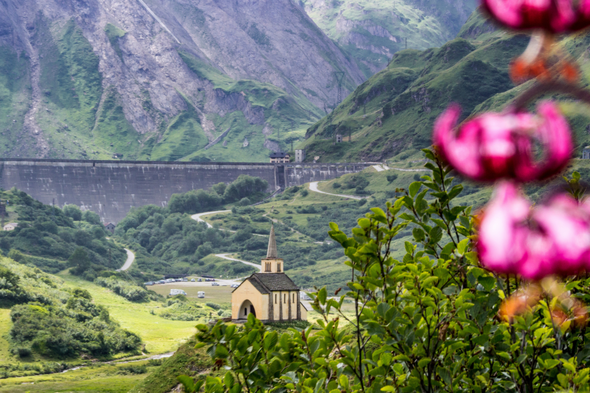
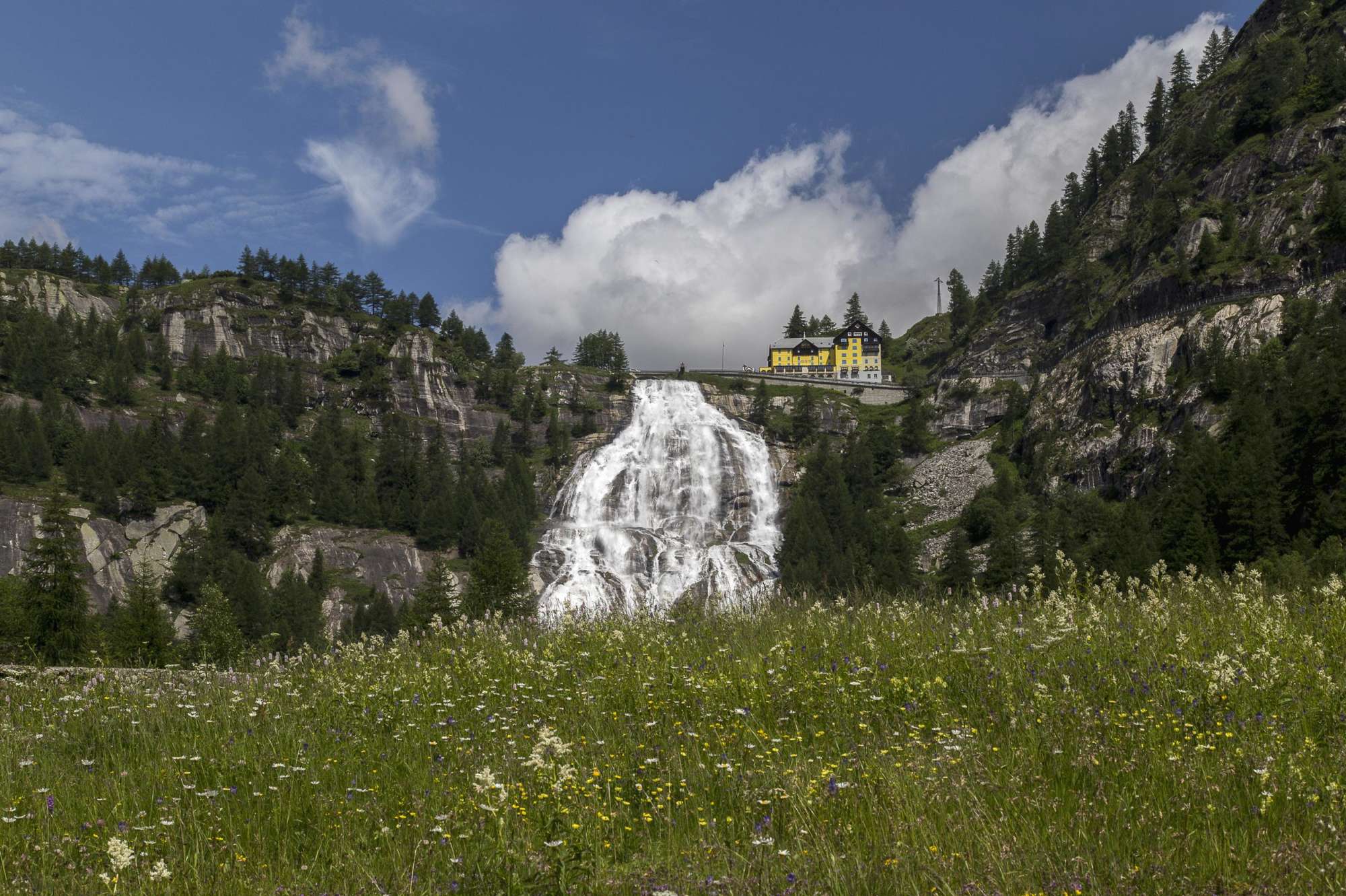
This route immediately offers an incredible natural spectacle, among the most photographed in the Alps: the Toce Falls, one of the highest waterfalls in Europe. The interweaving history of these mountains is immediate: the oratory dedicated to Sant’Antonio Abate dating back to 1621, the “Albergo della Cascata del Toce” built between 1862 and 1863, renovated in 1926 by the famous architect Piero Portaluppi, the Walser villages of Riale and Morasco, and the majestic dams of the upper Formazza Valley. Among the illustrious visitors to this part of the Ossola Valley was Queen Margherita of Savoia: the Formazza Valley became part of the then limited number of Italian winter and ski circuits. At the San Giacomo Pass (once accessible by car), the remains of one of the most imaginative structures of the Ossola Valley are still visible, designed by Piero Portalupi in 1930: the Wagristoratore. Consisting of two railway carriages (the first a restaurant and the second a hotel) at 2300 metres (7546 ft) above sea level, in operation until 1944.

Description

On arrival at the Toce Falls, after admiring the mighty waterfall from the wooden walkway, follow the path in the direction of Via del Gries, marked G00, until you reach Riale. At a fork in the road, take the San Giacomo Pass path until you cross route G20, which leads directly to the pass. Cross the path several times until you reach a flat section that takes you to the Maria Luisa Refuge. From here, follow signs for the dam, continuing on the road that runs alongside Lake Toggia and arriving at the San Giacomo Passo. Signposts indicate the Boden Lakes on trail G28a. Lakes, meadows and pastures form a wonderful natural landscape: when you come across the Via Alpina (VA), use it to descend to the Boden Lakes. Make a detour towards the dam, crossing over it to meet the route uphill and thus arrive again at the Maria Luisa Refuge. The return from the refuge is part of the way to Riale, a small Walser village which is worth a visit.

Useful info

Italian Alpine Club (CAI) site identification code

Sector G “Routes” – IG23

Useful info

Domodossola FS International Railway Station (from Bern and Milan).
From the BUS terminal, take the Formazza Valley bus route, getting off at Cascate del Toce (the Toce Falls).
Contact details: Municipality of Formazza
CAI contact details: Formazza Section
Refreshment areas: Maria Luisa Refuge

Difficulty

Medium difficulty. The route doesn’t have any difficulties per se, but requires good training to tackle the almost 20 km (12 miles) of high-altitude route.

Lenght

19,5 km

Ascent

731 m

Total duration

5 hrs 50 min

Recommended equipment

Hiking boots, windbreaker and technical mountain clothing.

Signage

G00 – G20 – G28a – G24

Best time of year

From late June to late September

Reference map(s)

Map no. 11 scale 1:25,000 of the Geo4Map/CAI
Digital maps on the following apps: ViewRanger – Avenza Maps

Historic, artistic and cultural value
Value of traditional and peasant life
Natural value
Ideal for
Everybody
You will discover
Nature
Sport
Guide to itineraries and useful info
Ideal for
Everybody
You will discover
Nature
Sport
Guide to itineraries and useful info
Choose your
mountain guide
IAT di Formazza
Frazione Ponte, 5 28863 Formazza (VB) See map
Choose your
tour or nature guide

You might also be interested in...