Hiking – Around Lake Devero
Difficulty
Medium
Period
Spring / Summer / Autumn

A route in the heart of the protected area of the Veglia Devero Natural Park, a charming natural environment that remains unspoilt to this day. Coniferous woods, fragrant alpine flora, emerald lakes, jagged peaks, ancient mountains and endless pastures: these are just some of the parts of the beautiful jigsaw that you can admire at walking pace along this unique and unmistakable route around Lake Devero.

Description

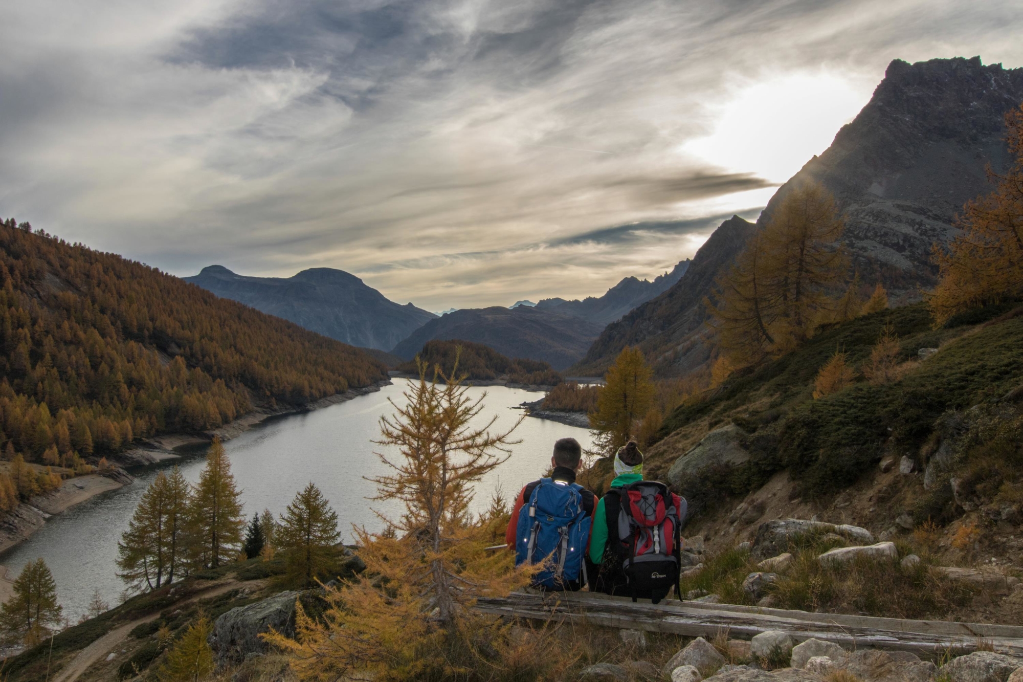
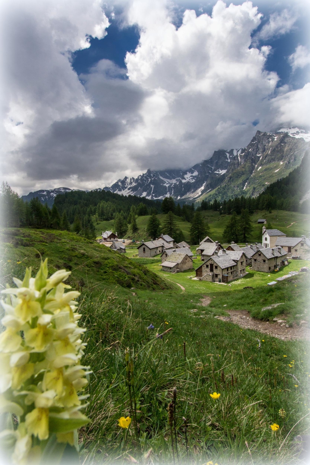
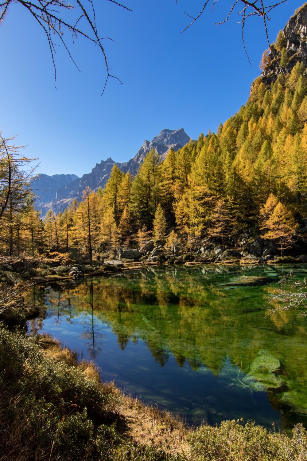
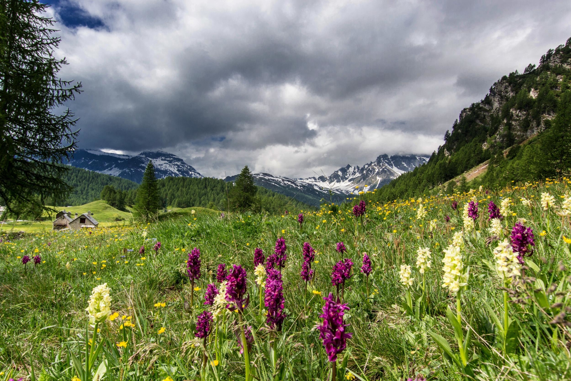
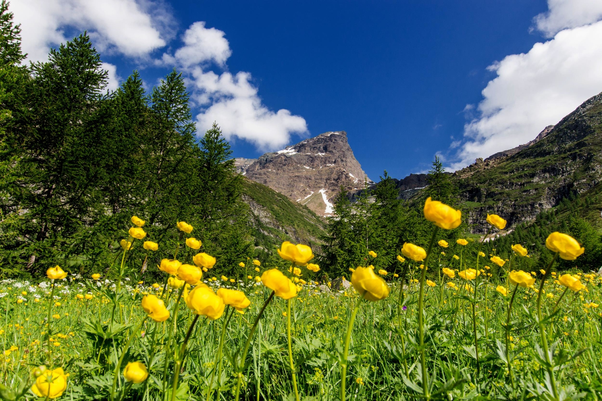
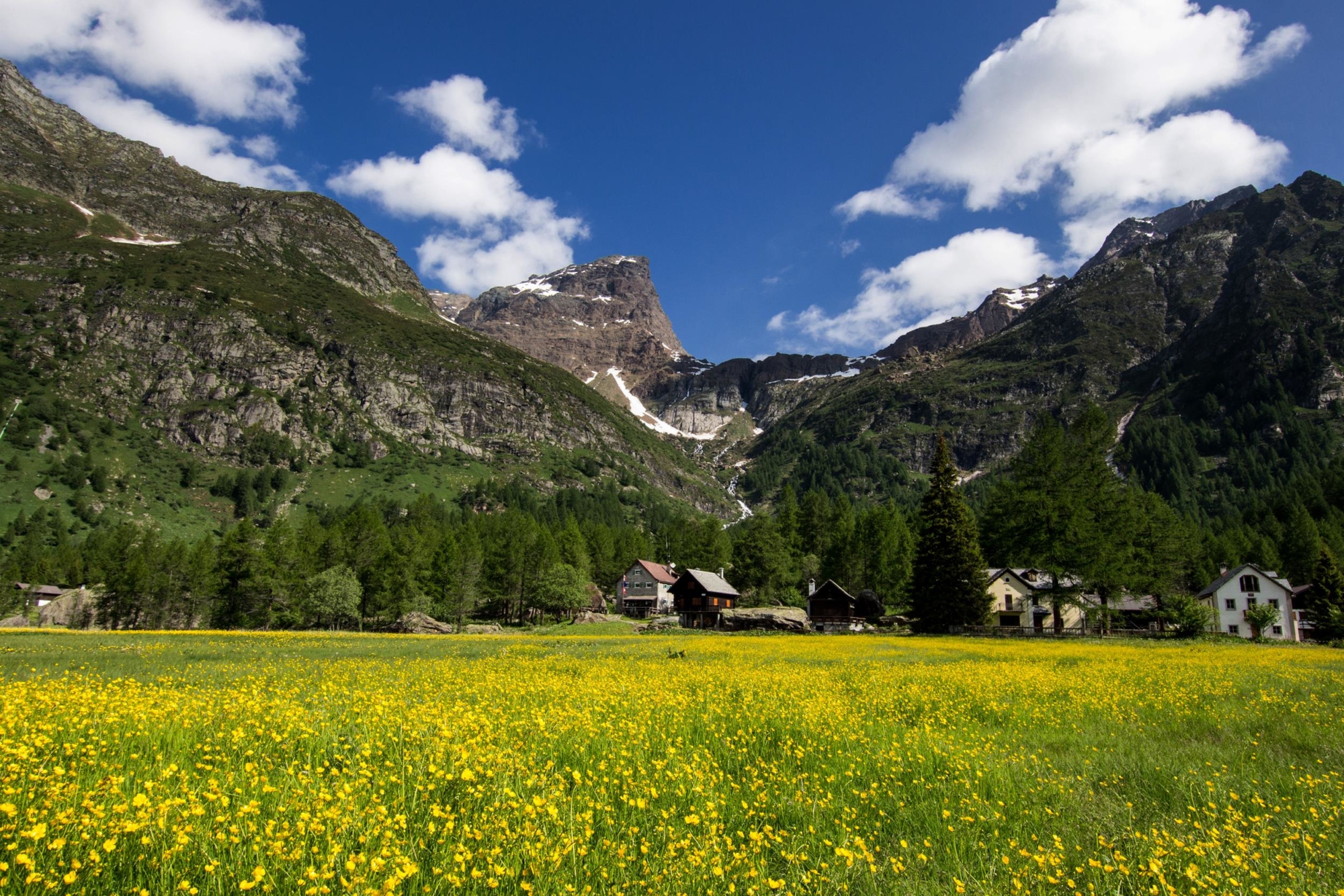
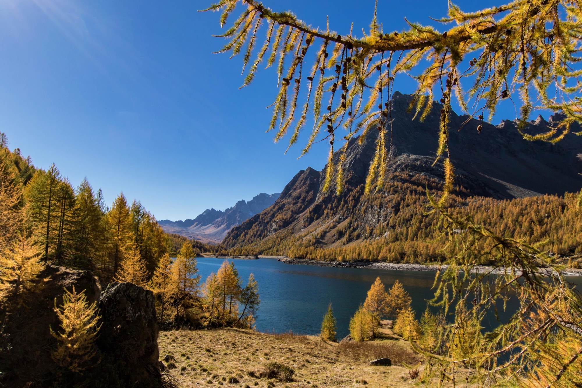
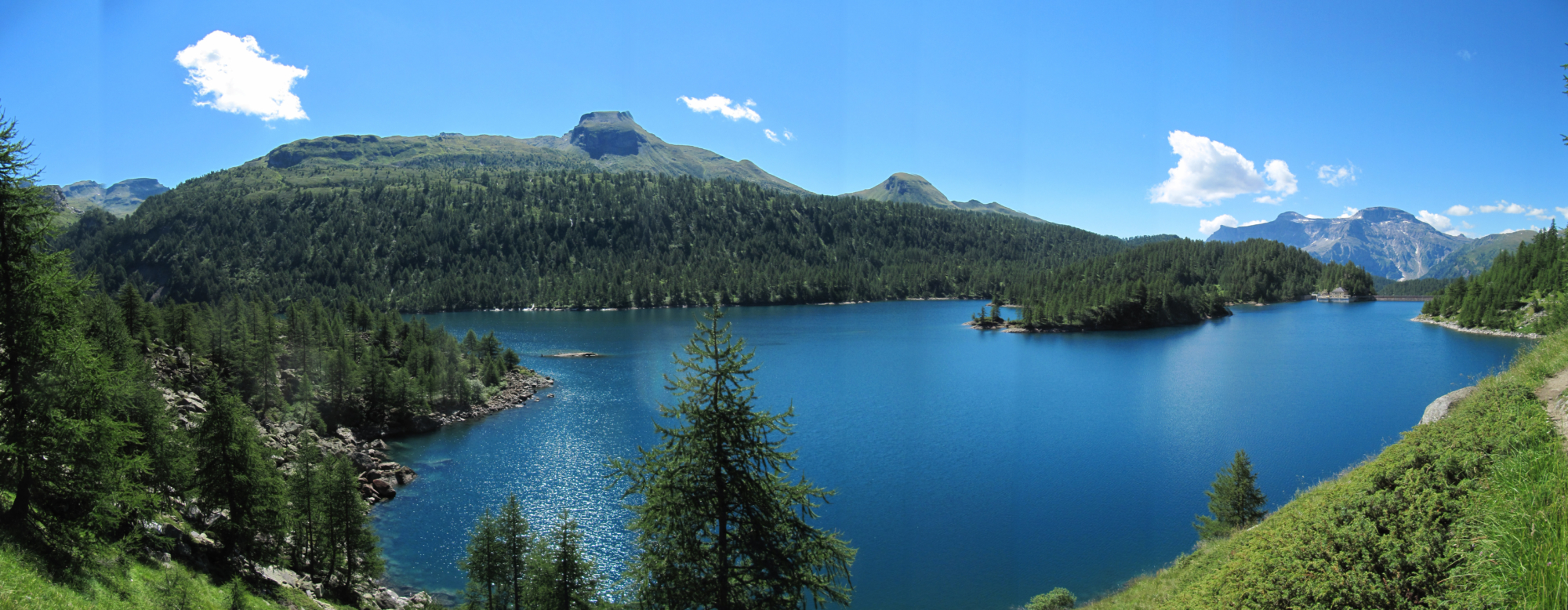
From the Alpe Devero car parks, take the paved road that goes up to the first huts and the oratory. Under the square of the Oratory the routes split; the one on the left leads to the plains of Buscagna, the one to the right onto the Devero plateau. Take the latter, crossing the bridge and leaving the path to the right for Corte d’Ardui, pass the junction for Alpe Crampiolo and you’ll reach Canton. Here the climb that leads to the beautiful plateau of Crampiolo begins. Turn left to reach the crystal clear Witches’ Lake (Lago delle Streghe), return to the junction to continue and cross a bridge along the path that leads to the Codelago dam. Once you reach the wall of the reservoir, take the path that runs alongside the dam until you reach the pasture of Codelago. Continue through sparse larch forest with splendid views that open onto the lake, until you reach the junction for Pianboglio, which you leave on the left to continue the route. You arrive at the fork for Alpe Forno and, after crossing the river via a bridge, you start the path that skirts the lake from the opposite side. Leave the path to Alpe della Valle on the left and reach the junction for the dam. From here the route starts to descend to reach Alpe Crampiolo. From Crampiolo, continue on a dirt road leaving the path to the right for the Witches’ Lake and reach the junction for Corte d’Ardui. Here you can follow the characteristic stretch of Corte d’Ardui or continue on the dirt road as far as Alpe Devero.

Useful info

Italian Alpine Club (CAI) site identification code

Sector H “Itineraries” – IH10

Useful info

Domodossola FS International Railway Station (from Bern and Milan).
From the Bus terminal, take the Formazza Valley bus route, getting off in Baceno.
From Baceno, take the Prontobus (tel. +39 349 0796016) to Alpe Devero.
By car, drive straight to the (paid) car parks at Alpe Devero.
Contact details: Municipality of Baceno
Protected Areas of Ossola
CAI contact details: Formazza Section

Difficulty

Medium difficulty. The route is not particularly difficult, but you’ll need to be careful in the stretch from Alpe Codelago to the end of the dam.

Lenght

13 km

Ascent

319 m

Total duration

3 hrs 35 min

Recommended equipment

Walking boots and mountain clothing.

Signage

H98a – H00 – H98

Best time of year

From June to October

Reference map(s)

Map no. 10 scale 1:25,000 of the Geo4Map/CAI
Digital maps on the following apps: ViewRanger – Avenza Maps

Value of traditional and peasant life
Natural value
Ideal for
Everybody
You will discover
Nature
Sport
Guide to itineraries and useful info
Ideal for
Everybody
You will discover
Nature
Sport
Guide to itineraries and useful info
Choose your
mountain guide
IAT di Crodo
Via Bagni, 20 28862 Crodo (VB) See map
Choose your
tour or nature guide

You might also be interested in...